
RTK GNSS for Sustainable Site Planning
From Mapping Existing Conditions to Final Grade


Sustainable site planning starts with reliable information about the ground before design moves into construction. Existing slopes, drainage paths, trees, utilities and disturbance limits all depend on location and elevation. When those inputs are wrong, teams risk extra excavation, material movement, wasted time and redesign.
This is where RTK GNSS (real-time kinematic global navigation satellite system) can make a practical difference. By combining satellite positioning with correction data, RTK GNSS is highly accurate. According to RTKdata, “accuracy is typically 1 to 2 cm horizontal and 2 to 3 cm vertical.” That level of precision allows survey and field teams to capture existing site conditions, establish design points and verify elevations with much greater confidence than conventional standalone GPS.
The technology does not replace good site design – it helps ensure that design decisions are based on accurate, location-specific information and that those decisions can be transferred correctly from plans to the ground. For sustainable projects, that can mean more precise grading, less unnecessary earthwork and better control over drainage, vegetation and other site features.
Better Site Decisions Start With Better Position Data
A useful existing conditions survey shows where design needs to respond to the land. Natural drainage, tree protection areas, access routes and existing grades all need a common spatial reference. RTK GNSS keeps later field checks tied to those same project coordinates, linking design intent with site execution.
How RTK Corrections Improve GNSS Positioning

Get the Green Building Project Checklist
Use this handy checklist on your next project to keep track of all the ways you can make your home more energy-efficient and sustainable.
From Satellite Position to Corrected Position
A standalone GNSS receiver calculates position from satellite signals, but orbit, clock, atmosphere and local signal effects limit accuracy. RTK adds corrections from fixed reference stations and uses carrier phase measurements to resolve position far more tightly.
What the Network Changes in the Field
With network RTK, the rover sends an approximate position through NMEA GGA. The service streams RTCM correction data through NTRIP. The receiver processes the data and reports solution status such as FLOAT or FIX. Critical layout and grade work belongs under RTK FIX.
| Project stage | RTK field task | Decision supported |
| Existing conditions | Record points and breaklines | Preserve or redesign around site features |
| Layout | Stake design coordinates | Place work inside approved limits |
| Excavation | Check cut and fill | Control earth movement |
| Grading | Verify spot elevations | Build drainage as designed |
Capturing Existing Site Conditions
Map the Surface Before Design
Crews need more than isolated points. Slope changes, ditch lines, retaining walls, pavement edges and other breaklines define how the surface behaves. Those observations feed terrain models used for grading, drainage and earthwork planning.
Record Features That Should Stay Undisturbed
The same workflow marks trees, habitat edges, existing services and protected zones. That creates visible field limits and a digital record for later checks. On sensitive sites, planned work and protected ground become measurable rather than interpretive.
Moving From Digital Plans to Physical Layout
Digital coordinates only create value when field setup matches the design. Before staking, crews need the correct reference system, project units, control points and vertical basis.
A clean layout routine includes:
- Load approved points, lines and surfaces into the controller
- Check a known control point before setting new work
- Stake offsets outside areas removed by excavation
- Save measured checks so later crews use the same record.
This turns the model into repeatable ground positions instead of a one-time set of stakes.
RTK During Excavation and Construction
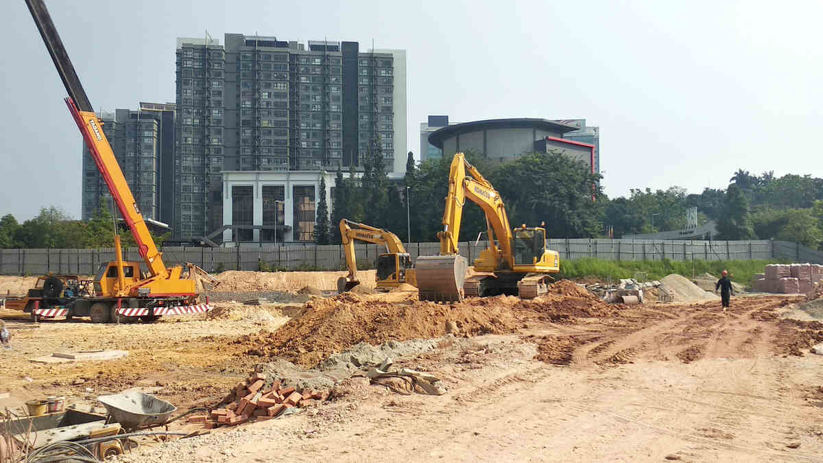
Excavation changes the site quickly, so layout needs repeated checks. RTK supports cut and fill verification, footing offsets, service locations and construction limits while adjustments still require limited labour and material.
Verify excavation depth before granular placement, footing position before concrete and service entries before backfill. Each check compares built work with design before the next layer hides it.
Using Accurate Elevations for Grading and Drainage
Drainage depends on elevation differences, not appearance. Swales, rain gardens, permeable areas and overflow routes only perform as designed when their inlets, outlets and intermediate grades match the plan.
Toronto’s Corktown Common gives a concrete example of topography driving sustainable site function. Waterfront Toronto reported in 2024 that the park sits on a flood protection landform, while its marsh captures and treats stormwater onsite. Precise positioning does not design such systems. It gives field teams the elevation checks needed to build the intended surface.
Where Better Positioning Can Reduce Site Disturbance and Rework
Positioning supports sustainability when it prevents unnecessary work. Verified limits keep equipment inside planned disturbance zones, while cut and fill checks reduce over-excavation and extra material handling. Repeated layout checks also catch shifts before concrete, drainage layers or landscaping cover the work. These controls fit with guidance on responsible site preparation and habitat protection, which emphasizes defined work areas, erosion control and protection of sensitive features.
The field routine is straightforward:
- Mark protected and work zones in the same coordinate system
- Check cut and fill before moving another load
- Verify grade breaks before placing final material
- Recheck critical points after equipment traffic or stake loss.
RTK does not make a project sustainable by itself. It gives the team tighter control over where work happens and whether the finished surface matches the approved design.
Why Network RTK Simplifies Field Operations
A local base station needs a stable setup point, known coordinates, power and a rover link. Network RTK moves that reference infrastructure outside the job site. A compatible rover connects through cellular or other internet service, sends its position and receives corrections.
For teams moving between properties, that removes daily base deployment and keeps one correction workflow across covered areas.
Accuracy, Reference Systems and Verification
Match the Project Reference
Centimetre precision loses its value when coordinates belong to the wrong reference frame. Ontario’s updated GNSS geodetic control specification requires high-precision GNSS work to use the appropriate official datum and antenna calibration tied to the intended reference frame. For construction teams, the underlying lesson is straightforward: project coordinates, receiver settings and the positioning reference have to agree before field measurements guide excavation or grading.
RTK GNSS reports ellipsoidal height, while site plans generally work with elevations tied to a defined vertical datum or project benchmark. The field workflow therefore needs the correct geoid model or project transformation before GNSS heights are compared with design elevations.
Verify Before Relying on the Number
Before production work, confirm correction coverage, internet access, antenna height, datum, projection, and vertical model. Then measure a known control point to test the full chain from satellite observations to displayed coordinate.
Repeat that check after loss of FIX, a settings change, or a move to another project. Sustainable site work depends on measurements that remain traceable and repeatable. That discipline turns precise positioning into better site decisions from first survey through final grade.
Images from Depositphotos
